Professional Surveying Work
for Buffalo; Erie County & Niagara County, NY
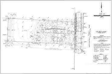
At True North Land Surveying PLLC, we stand at the forefront of precision and reliability in land surveying, whether it’s a meticulous boundary survey, comprehensive topographic survey work, or strategic plot planning for your next development. Our experienced land surveyor team crafts detailed survey maps that serve as the cornerstone for successful land development projects. From raw parcels of land to fully planned and surveyed sites, we deliver clear, professional, and actionable documentation that helps architects, developers, and property owners move forward with confidence. Browse our portfolio and give us a call to get started. We proudly serve the Buffalo, NY area.
What Is the Purpose of a Survey?
When members of the American Land Title Association® (ALTA®) are asked to insure title to land, they have to account for specific matters such as physical characteristics and boundaries related to the land. Many of these matters, which are unique to title insurance, may not be found in public records and have to be discovered through a survey.
The real property must be free and clear of survey matters – except for any matters disclosed by the survey or map – in order to be acceptable to the title insurance company. The survey must present specific and pertinent information that provides a clear understanding for all the involved parties. These parties include the lender, the surveyor, the title insurance company (insurer), the insured, and the client (if different from the insured). These parties are entitled to hire companies like True North Land Surveying PLLC to conduct surveys that are complete and accurate.
To that end, and in the interests of the general public, the surveying profession, title insurers and abstracters, the ALTA® and the NSPS jointly promulgate the within details and criteria setting forth a minimum standard of performance for ALTA®/NSPS Land Title Surveys.
Construction Control Surveys
Many of the on-site services we offer construction companies include:
- Setting and/or verifying vertical and horizontal control
- Building pad certifications
- Stake out and/or verification of column lines, anchor bolt, and pier locations
- Stake out and/or verification of foundation corner locations
- Stake out facilities such as catch basins, manholes, light poles, curbing, walks, and signs
- Set grade stakes for retention/detention ponds
All of these procedures are very important to help ensure there are no problems with the construction phase of the project and the project moves forward in a precise and timely manner.
Remote Rural Surveys
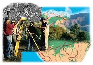
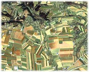
At True North Land Surveying PLLC, we have prepared boundary and topographic surveys for rural properties located throughout New York State. Many of these surveys require surveying large farms and plots of land, sometimes encompassing hundreds of acres of land.
Using the latest GPS and electronic technology, our field crews can easily and accurately measure and locate the boundary lines of heavily wooded and hilly parcels.
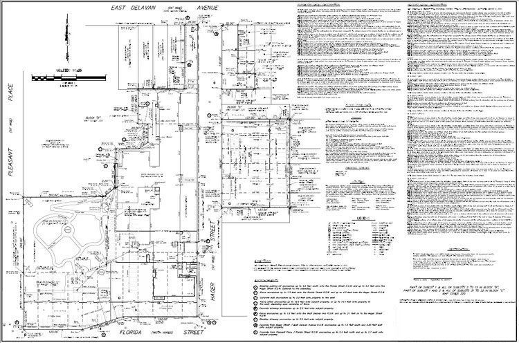
Topographic Surveys
Topographic surveys are used to determine the varying contours of the grade of the land, as well as existing surface features of the property being surveyed. These features include trees, buildings, utility poles, manholes, drainage structures, utility locations, and more.
Our field crews utilize electronic total station surveying equipment with electronic data collection for all field work. Resulting topographic survey maps are prepared with computerized programs and are ready for distribution in AutoCAD format for your design work needs. We also utilize Geographical Positioning Systems (GPS) equipment for State Plane Coordinates and datum-specific elevations.
Elevation Certificates
The Elevation Certificate is used by the National Flood Insurance Program (NFIP) to collect elevation information necessary to comply with a number of regulations and ordinances. This certificate must be completed by an authorized land surveyor, engineer, or architect when the real property is in a zone with flooding hazards.
The collection of elevation data by a land surveyor is used to ensure compliance with floodplain management laws, as well as to determine insurance premiums, or to support a request for a Letter of Map Amendment or Revision (LOMA or LOMR-F). If you are attempting to obtain a LOMA or LOMR-F, your request must include a certified evaluation of the lowest floor and lowest adjacent grade elevations.
Only a LOMA or LOMR-F from the Federal Emergency Management Agency (FEMA) can waive a federal mandate to purchase flood insurance. The Elevation Certificate does not provide this waiver, but it is required as a supporting document in your request to obtain a LOMA or LOMR-F. Even if you receive a LOMA or LOMR-F, the lending institution is allowed to require the purchase of flood insurance.
True North Land Surveying PLLC and our predecessors have years of experience helping our clients avoid or reduce the expensive cost of flood insurance. We can get the proper field measurements and file the necessary forms with all the required information.